


Buried ice discovered under the steep slopes of Mars
There have been eight sites detailed to harbour water ice under its surface
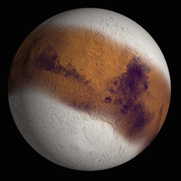
During Mars’ evolution, the tit of Mars could have led to an ice build-up closer to the planet’s equator. Image credit: NASA
NASA’s Mars Reconnaissance Orbiter (MRO) has spotted eight sites beneath the Martian surface where thick deposits of ice are exposed in faces of eroding slopes. These eight scarps – some as steep as 55 degrees – tell us previously unknown information about the internal layered structure of these ice sheets at Mars’ middle latitudes.
It’s most likely that the ice was originally deposited as snow a long time ago. These deposits are exposed in cross section as relatively pure water ice, from this they were covered by a layer of ice-cemented rock and dust one or two metres thick. Analysing this information could unveil Mars’ climate history, and could also provide helpful resources for future robotic or human exploration missions.
These sights were studied using the High Resolution Imaging Science Experiment (HiRISE) camera on MRO. The sites are in both the northern and southern hemispheres of Mars, ranging from about 55 to 58 degrees. This is equivalent on Earth to Scotland or the tip of South America.
“There is shallow ground ice under roughly a third of the Martian surface, which records the recent history of Mars,” says Colin Dundas of the U.S. Geological Survey’s Astrogeology Science Center in Flagstaff, Arizona. “What we’ve seen here are cross-sections through the ice that give us a 3-D view with more detail than ever before.”
The scarps directly expose distinct glimpses into large amounts of underground ice. This has previously been detected by the spectrometers on NASA’s Mars Odyssey orbiter, ground-penetrating radar instruments on MRO, the European Space Agency’s Mars Express orbiter and with other observations showing subsurface ice in fresh impact craters. NASA launched the Phoenix lander in 2007 to follow up on Odyssey’s findings. This led the Phoenix confirming and analysing the buried water ice at 68 degrees north latitude in 2008.
“The discovery reported today gives us surprising windows where we can see right into these thick underground sheets of ice,” says Shane Byrne of the University of Arizona Lunar and Planetary Laboratory, Tucson. “It’s like having one of those ant farms where you can see through the glass on the side to learn about what’s usually hidden beneath the ground.”
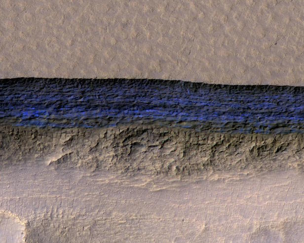
The thick sheet of underground ice has been exposed by the steep slope appears bright blue in this enhanced-colour image. Image credit: NASA/JPL-Caltech/UA/USGS
Scientists have yet been able to deduce how these structures formed, but it has been detailed that once the buried ice is exposed to the Martian atmosphere, a scarp likely grows wider and taller. This is because it “retreats” as a result of sublimation of the ice from solid form into water vapour. At some deposits, the exposed water ice is more than 100 metres thick. Further analysis from MRO’s Compact Reconnaissance Imaging Spectrometer for Mars (CRISM) confirmed that the bright material is frozen water. Odyssey’s Thermal Emission Imaging System (THEMIS) camera then checked the surface temperature to make sure it wasn’t just a thin frost covering the ground.
MRO’s Shallow Radar (SHARAD) had previously mapped a large area of underground water-ice sheets in middle latitudes of Mars. From this, they estimated that the ice is less that about 10 metres beneath the ground surface. Unfortunately, the radar method could not give enough resolution to specify, however the latest ice-scarp studies confirm that a layer, rich in water ice, begins within just one or two metres of the surface in some areas. This discovery came from fresh-crater and neutron-spectrometer observations.
Not only does this study confirm the existence of underground water ice, but also it outlines eight possible sites to extract such a valuable resource in less hostile conditions than at the polar caps. “Astronauts could essentially just go there with a bucket and a shovel and get all the water they need,” explains Byrne.
The ice has more scientific value than its potential resource value because it could reveal long-term patterns about Mars’ climate. The nature of Mars’ axis of rotation tilt fluctuates more rapidly than Earth’s, lasting millions of years. These days, the tilts of the two planets are about the same. In the days where Mars was tilted more, the climate conditions may have led to a build-up of middle-latitude ice. Dundas and collaborators say that banding the colour variations, which are present in some scarps, suggest layers “possibly deposited with changes in the proportion of ice and dust under varying climate conditions.”
This study benefitted from the use of several Mars orbiters and their essential individual orbiters, plus the fact MRO and Odyssey has been studying Mars for 11 and 16 years respectively. And it doesn’t stop there, as orbiters will continue to make observations and future missions could seek additional information.
“If you had a mission at one of these sites, sampling the layers going down the scarp, you could get a detailed climate history of Mars,” suggests MRO Deputy Project Scientist Leslie Tamppari of NASA’s Jet Propulsion Laboratory, Pasadena, California. “It’s part of the whole story of what happens to water on Mars over time: Where does it go? When does ice accumulate? When does it recede?”
Keep up to date with the latest reviews in All About Space – available every month for just £4.99. Alternatively you can subscribe here for a fraction of the price!